Punta Roca (La Punta / The Point) Surf Report
| Wave height * | 3ft / 0.9m |
|---|---|
| Swell period | 16s |
| Swell direction | |
| Wind | |
| Sea temp | 31°C / 87°F |

10 day Punta Roca surf forecast
Wed
18/Sep
3ft
4
2
4
- High 3:34am
- Low 9:31am
- High 3:55pm
- Low 9:48pm
Thu
19/Sep
3ft
2
7
4
- High 4:21am
- Low 10:18am
- High 4:42pm
- Low 10:34pm
Fri
20/Sep
3.5ft
1
4
3
- High 5:08am
- Low 11:05am
- High 5:29pm
- Low 11:20pm
Sat
21/Sep
3.5ft
5
5
5
- High 5:55am
- Low 11:52am
- High 6:17pm
Sun
22/Sep
3ft
4
5
6
- Low 12:07am
- High 6:44am
- Low 12:41pm
- High 7:07pm
Mon
23/Sep
3.5ft
6
7
3
- Low 12:56am
- High 7:35am
- Low 1:32pm
- High 8:01pm
Tue
24/Sep
5ft
4
6
2
- Low 1:50am
- High 8:31am
- Low 2:28pm
- High 9:02pm
Wed
25/Sep
7ft
4
3
4
- Low 2:52am
- High 9:34am
- Low 3:34pm
- High 10:15pm
Thu
26/Sep
4ft
6
13
11
- Low 4:06am
- High 10:45am
- Low 4:49pm
- High 11:33pm
Wed 18th Sep
| 3:00 | 3ft | 4ft | 16s | 5mph (5mph) | |||
| 6:00 | 3ft | 4ft | 16s | 4mph (4mph) | |||
| 9:00 | 3ft | 3.9ft | 16s | 4mph (4mph) | |||
| 12:00 | 3ft | 3.9ft | 16s | 2mph (2mph) | |||
| 15:00 | 3ft | 3.9ft | 15s | 6mph (4mph) | |||
| 18:00 | 3ft | 3.9ft | 15s | 4mph (5mph) | |||
| 21:00 | 3ft | 3.9ft | 15s | 5mph (7mph) |
| Tide times |
|---|
| High 3:34am (10.92m) |
| Low 9:31am (-1.01m) |
| High 3:55pm (10.67m) |
| Low 9:48pm (-0.97m) |
| Daylight | |
|---|---|
| First light | 05:25 |
| Sunrise | 05:46 |
| Sunset | 17:56 |
| Dark | 18:17 |
Thu 19th Sep
| 3:00 | 3ft | 3.9ft | 15s | 3mph (3mph) | |||
| 6:00 | 3ft | 3.9ft | 15s | 2mph (2mph) | |||
| 9:00 | 3ft | 4ft | 15s | 4mph (3mph) | |||
| 12:00 | 3ft | 4ft | 14s | 7mph (5mph) | |||
| 15:00 | 3ft | 4.1ft | 14s | 7mph (7mph) | |||
| 18:00 | 3.5ft | 4.2ft | 14s | 4mph (6mph) | |||
| 21:00 | 3.5ft | 4.4ft | 14s | 6mph (9mph) |
| Tide times |
|---|
| High 4:21am (11.32m) |
| Low 10:18am (-1.28m) |
| High 4:42pm (10.68m) |
| Low 10:34pm (-1.04m) |
| Daylight | |
|---|---|
| First light | 05:25 |
| Sunrise | 05:46 |
| Sunset | 17:55 |
| Dark | 18:16 |
Fri 20th Sep
| 3:00 | 3ft | 4.4ft | 14s | 4mph (6mph) | |||
| 6:00 | 3ft | 4.4ft | 13s | 1mph (2mph) | |||
| 9:00 | 3.5ft | 4.3ft | 13s | 1mph (2mph) | |||
| 12:00 | 3.5ft | 4.4ft | 13s | 4mph (3mph) | |||
| 15:00 | 3.5ft | 4.4ft | 13s | 4mph (5mph) | |||
| 18:00 | 3.5ft | 4.4ft | 13s | 3mph (4mph) | |||
| 21:00 | 3.5ft | 4.3ft | 13s | 4mph (4mph) |
| Tide times |
|---|
| High 5:08am (11.39m) |
| Low 11:05am (-1.20m) |
| High 5:29pm (10.43m) |
| Low 11:20pm (-0.79m) |
| Daylight | |
|---|---|
| First light | 05:25 |
| Sunrise | 05:46 |
| Sunset | 17:54 |
| Dark | 18:15 |
Sat 21st Sep
| 3:00 | 3.5ft | 4.2ft | 8s | 5mph (6mph) | |||
| 6:00 | 3.5ft | 4.3ft | 8s | 5mph (6mph) | |||
| 9:00 | 3.5ft | 4.3ft | 8s | 1mph (2mph) | |||
| 12:00 | 3.5ft | 4.2ft | 10s | 5mph (3mph) | |||
| 15:00 | 3ft | 4.1ft | 12s | 6mph (6mph) | |||
| 18:00 | 3ft | 4ft | 12s | 5mph (7mph) | |||
| 21:00 | 3ft | 4ft | 7s | 3mph (5mph) |
| Tide times |
|---|
| High 5:55am (11.14m) |
| Low 11:52am (-0.79m) |
| High 6:17pm (9.94m) |
| Daylight | |
|---|---|
| First light | 05:25 |
| Sunrise | 05:46 |
| Sunset | 17:53 |
| Dark | 18:15 |
Sun 22nd Sep
| 3:00 | 3ft | 3.9ft | 7s | 2mph (2mph) | |||
| 6:00 | 3ft | 3.9ft | 7s | 4mph (6mph) | |||
| 9:00 | 3ft | 3.8ft | 7s | 3mph (4mph) | |||
| 12:00 | 3ft | 3.9ft | 7s | 5mph (3mph) | |||
| 15:00 | 3ft | 4ft | 15s | 2mph (3mph) | |||
| 18:00 | 3.5ft | 4.2ft | 20s | 6mph (8mph) | |||
| 21:00 | 3.5ft | 4.4ft | 19s | 6mph (8mph) |
| Tide times |
|---|
| Low 12:07am (-0.26m) |
| High 6:44am (10.60m) |
| Low 12:41pm (-0.13m) |
| High 7:07pm (9.28m) |
| Daylight | |
|---|---|
| First light | 05:25 |
| Sunrise | 05:46 |
| Sunset | 17:53 |
| Dark | 18:14 |
Mon 23rd Sep
| 3:00 | 3.5ft | 4.4ft | 19s | 5mph (6mph) | |||
| 6:00 | 3.5ft | 4.4ft | 19s | 6mph (7mph) | |||
| 9:00 | 3.5ft | 4.3ft | 17s | 6mph (10mph) | |||
| 12:00 | 3.5ft | 4.3ft | 13s | 7mph (7mph) | |||
| 15:00 | 3.5ft | 4.4ft | 18s | 5mph (5mph) | |||
| 18:00 | 3.5ft | 4.5ft | 18s | 3mph (3mph) | |||
| 21:00 | 3.5ft | 4.5ft | 18s | 4mph (4mph) |
| Tide times |
|---|
| Low 12:56am (0.47m) |
| High 7:35am (9.89m) |
| Low 1:32pm (0.67m) |
| High 8:01pm (8.58m) |
| Daylight | |
|---|---|
| First light | 05:25 |
| Sunrise | 05:46 |
| Sunset | 17:52 |
| Dark | 18:13 |
Tue 24th Sep
| 3:00 | 3.5ft | 4.6ft | 18s | 3mph (3mph) | |||
| 6:00 | 4ft | 4.8ft | 18s | 4mph (4mph) | |||
| 9:00 | 4ft | 5ft | 18s | 1mph (2mph) | |||
| 12:00 | 5ft | 5.7ft | 8s | 6mph (5mph) | |||
| 15:00 | 6ft | 7.4ft | 8s | 6mph (6mph) | |||
| 18:00 | 7ft | 9.2ft | 8s | 2mph (3mph) | |||
| 21:00 | 7.5ft | 9.5ft | 9s | 1mph (2mph) |
| Tide times |
|---|
| Low 1:50am (1.29m) |
| High 8:31am (9.13m) |
| Low 2:28pm (1.47m) |
| High 9:02pm (7.95m) |
| Daylight | |
|---|---|
| First light | 05:25 |
| Sunrise | 05:46 |
| Sunset | 17:51 |
| Dark | 18:12 |
Wed 25th Sep
| 3:00 | 6.5ft | 8.3ft | 9s | 3mph (3mph) | |||
| 6:00 | 6ft | 7.9ft | 9s | 4mph (4mph) | |||
| 9:00 | 6ft | 8.1ft | 9s | 2mph (2mph) | |||
| 12:00 | 7ft | 10.5ft | 9s | 3mph (3mph) | |||
| 15:00 | 6.5ft | 9.4ft | 9s | 1mph (2mph) | |||
| 18:00 | 5ft | 7.7ft | 8s | 4mph (7mph) | |||
| 21:00 | 4.5ft | 7.3ft | 9s | 4mph (5mph) |
| Tide times |
|---|
| Low 2:52am (2.04m) |
| High 9:34am (8.48m) |
| Low 3:34pm (2.11m) |
| High 10:15pm (7.56m) |
| Daylight | |
|---|---|
| First light | 05:25 |
| Sunrise | 05:46 |
| Sunset | 17:51 |
| Dark | 18:12 |
Thu 26th Sep
| 3:00 | 8ft | 12.6ft | 10s | 4mph (7mph) | |||
| 6:00 | 5.5ft | 9.9ft | 10s | 6mph (9mph) | |||
| 9:00 | 4.5ft | 7.9ft | 9s | 7mph (11mph) | |||
| 12:00 | 4ft | 6.9ft | 9s | 13mph (16mph) | |||
| 15:00 | 4ft | 7.1ft | 9s | 13mph (17mph) | |||
| 18:00 | 4.5ft | 7.9ft | 9s | 11mph (17mph) | |||
| 21:00 | 7.5ft | 11.6ft | 10s | 10mph (17mph) |
| Tide times |
|---|
| Low 4:06am (2.51m) |
| High 10:45am (8.07m) |
| Low 4:49pm (2.42m) |
| High 11:33pm (7.50m) |
| Daylight | |
|---|---|
| First light | 05:25 |
| Sunrise | 05:46 |
| Sunset | 17:50 |
| Dark | 18:11 |
Fri 27th Sep
| 3:00 | 7.5ft | 13.1ft | 10s | 8mph (13mph) | |||
| 6:00 | 6ft | 10.5ft | 9s | 9mph (13mph) | |||
| 9:00 | 4.5ft | 8.8ft | 8s | 6mph (8mph) | |||
| 12:00 | 4ft | 7.7ft | 8s | 11mph (11mph) | |||
| 15:00 | 4ft | 7.2ft | 7s | 12mph (16mph) | |||
| 18:00 | 4ft | 7.1ft | 7s | 11mph (17mph) |
| Tide times |
|---|
| Low 5:27am (2.58m) |
| Daylight | |
|---|---|
| First light | 05:25 |
| Sunrise | 05:46 |
| Sunset | 17:49 |
| Dark | 18:10 |
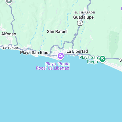
Long, powerful right pontbreak that has been compared to J-Bay when it's on. Hollow sections break over shallow black boulder bottom. Quality of wave and proximity to town mean it can get busy
Surf spots nearby
Not Magic Seaweed (MSW)
Although we look a bit like Magic Seaweed we are not MagicSeaweed as they no longer exist...