Sayulita (Punta Sayulita) Surf Report
| Wave height * | 0.5ft / 0.2m |
|---|---|
| Swell period | 12s |
| Swell direction | |
| Wind | |
| Sea temp | 30°C / 87°F |
10 day Sayulita surf forecast
Fri
18/Oct
0.5ft
3
3
5
- Low 3:14am
- High 9:18am
- Low 3:54pm
- High 10:10pm
Sat
19/Oct
1ft
7
11
10
- Low 3:38am
- High 9:45am
- Low 4:32pm
- High 10:49pm
Sun
20/Oct
1ft
10
9
8
- Low 3:59am
- High 10:12am
- Low 5:14pm
- High 11:34pm
Mon
21/Oct
1.5ft
12
9
11
- Low 4:14am
- High 10:38am
- Low 6:05pm
Tue
22/Oct
1.5ft
8
8
16
- High 12:39am
- Low 4:01am
- High 11:00am
- Low 7:30pm
Wed
23/Oct
1ft
5
7
6
- High 10:50am
- Low 11:01pm
Thu
24/Oct
1ft
13
5
3
- High 7:54am
- Low 1:15pm
- High 4:42pm
Fri
25/Oct
1ft
6
7
4
- Low 12:15am
- High 7:28am
- Low 1:04pm
- High 6:15pm
Sat
26/Oct
1ft
8
8
5
- Low 12:53am
- High 7:34am
- Low 1:22pm
- High 7:00pm
Fri 18th Oct
| 3:00 | 0.5ft | 2.4ft | 12s | 2mph (2mph) | |||
| 6:00 | 1ft | 2.4ft | 12s | 3mph (2mph) | |||
| 9:00 | 1ft | 2.3ft | 12s | 5mph (4mph) | |||
| 12:00 | 0.5ft | 2.3ft | 12s | 3mph (3mph) | |||
| 15:00 | 0.5ft | 2.2ft | 12s | 7mph (6mph) | |||
| 18:00 | 1ft | 2.2ft | 12s | 5mph (5mph) | |||
| 21:00 | 1ft | 2.1ft | 13s | 5mph (5mph) |
| Tide times |
|---|
| Low 3:14am (0.12m) |
| High 9:18am (1.40m) |
| Low 3:54pm (-0.23m) |
| High 10:10pm (1.08m) |
| Daylight | |
|---|---|
| First light | 06:36 |
| Sunrise | 06:58 |
| Sunset | 18:35 |
| Dark | 18:57 |
Sat 19th Oct
| 3:00 | 0.5ft | 2ft | 11s | 7mph (7mph) | |||
| 6:00 | 0.5ft | 2ft | 11s | 7mph (8mph) | |||
| 9:00 | 0.5ft | 2ft | 11s | 11mph (11mph) | |||
| 12:00 | 1ft | 2ft | 16s | 11mph (11mph) | |||
| 15:00 | 1ft | 2.1ft | 16s | 12mph (12mph) | |||
| 18:00 | 1ft | 2.2ft | 14s | 10mph (10mph) | |||
| 21:00 | 1ft | 2.3ft | 15s | 9mph (9mph) |
| Tide times |
|---|
| Low 3:38am (0.23m) |
| High 9:45am (1.39m) |
| Low 4:32pm (-0.16m) |
| High 10:49pm (0.95m) |
| Daylight | |
|---|---|
| First light | 06:36 |
| Sunrise | 06:58 |
| Sunset | 18:34 |
| Dark | 18:56 |
Sun 20th Oct
| 3:00 | 1ft | 2.3ft | 15s | 8mph (8mph) | |||
| 6:00 | 1ft | 2.4ft | 15s | 10mph (10mph) | |||
| 9:00 | 1ft | 2.7ft | 19s | 9mph (10mph) | |||
| 12:00 | 1ft | 2.9ft | 19s | 9mph (10mph) | |||
| 15:00 | 1ft | 3ft | 17s | 9mph (10mph) | |||
| 18:00 | 1ft | 3ft | 17s | 8mph (8mph) | |||
| 21:00 | 1ft | 3.1ft | 14s | 7mph (8mph) |
| Tide times |
|---|
| Low 3:59am (0.35m) |
| High 10:12am (1.33m) |
| Low 5:14pm (-0.04m) |
| High 11:34pm (0.79m) |
| Daylight | |
|---|---|
| First light | 06:36 |
| Sunrise | 06:59 |
| Sunset | 18:33 |
| Dark | 18:56 |
Mon 21st Oct
| 3:00 | 1ft | 3.6ft | 19s | 12mph (13mph) | |||
| 6:00 | 1ft | 4ft | 19s | 12mph (13mph) | |||
| 9:00 | 1ft | 4.1ft | 19s | 8mph (9mph) | |||
| 12:00 | 1.5ft | 4.5ft | 18s | 9mph (9mph) | |||
| 15:00 | 1.5ft | 4.9ft | 18s | 13mph (13mph) | |||
| 18:00 | 1.5ft | 5.1ft | 18s | 11mph (12mph) | |||
| 21:00 | 1.5ft | 5.1ft | 18s | 8mph (9mph) |
| Tide times |
|---|
| Low 4:14am (0.47m) |
| High 10:38am (1.22m) |
| Low 6:05pm (0.12m) |
| Daylight | |
|---|---|
| First light | 06:37 |
| Sunrise | 06:59 |
| Sunset | 18:32 |
| Dark | 18:55 |
Tue 22nd Oct
| 3:00 | 1.5ft | 5ft | 16s | 9mph (9mph) | |||
| 6:00 | 1.5ft | 5ft | 16s | 8mph (9mph) | |||
| 9:00 | 1.5ft | 5.1ft | 16s | 5mph (6mph) | |||
| 12:00 | 1.5ft | 5ft | 16s | 8mph (9mph) | |||
| 15:00 | 1.5ft | 4.9ft | 16s | 16mph (16mph) | |||
| 18:00 | 1.5ft | 4.7ft | 16s | 16mph (16mph) | |||
| 21:00 | 1.5ft | 4.5ft | 15s | 6mph (6mph) |
| Tide times |
|---|
| High 12:39am (0.65m) |
| Low 4:01am (0.57m) |
| High 11:00am (1.07m) |
| Low 7:30pm (0.28m) |
| Daylight | |
|---|---|
| First light | 06:37 |
| Sunrise | 07:00 |
| Sunset | 18:32 |
| Dark | 18:54 |
Wed 23rd Oct
| 3:00 | 1ft | 4.1ft | 15s | 2mph (2mph) | |||
| 6:00 | 1ft | 4ft | 15s | 5mph (5mph) | |||
| 9:00 | 1ft | 3.8ft | 15s | 2mph (2mph) | |||
| 12:00 | 1ft | 3.7ft | 14s | 7mph (7mph) | |||
| 15:00 | 1ft | 3.6ft | 14s | 7mph (8mph) | |||
| 18:00 | 1ft | 3.5ft | 14s | 6mph (6mph) | |||
| 21:00 | 1ft | 3.4ft | 14s | 5mph (5mph) |
| Tide times |
|---|
| High 10:50am (0.92m) |
| Low 11:01pm (0.31m) |
| Daylight | |
|---|---|
| First light | 06:38 |
| Sunrise | 07:00 |
| Sunset | 18:31 |
| Dark | 18:53 |
Thu 24th Oct
| 3:00 | 1ft | 3.3ft | 14s | 10mph (10mph) | |||
| 6:00 | 1.5ft | 3.3ft | 18s | 13mph (13mph) | |||
| 9:00 | 1.5ft | 3.3ft | 18s | 12mph (12mph) | |||
| 12:00 | 1ft | 3.3ft | 18s | 5mph (5mph) | |||
| 15:00 | 1ft | 3.2ft | 18s | 2mph (2mph) | |||
| 18:00 | 1ft | 3.1ft | 15s | 3mph (3mph) | |||
| 21:00 | 1ft | 2.9ft | 13s | 7mph (7mph) |
| Tide times |
|---|
| High 7:54am (0.87m) |
| Low 1:15pm (0.73m) |
| High 4:42pm (0.78m) |
| Daylight | |
|---|---|
| First light | 06:38 |
| Sunrise | 07:00 |
| Sunset | 18:30 |
| Dark | 18:53 |
Fri 25th Oct
| 3:00 | 1ft | 3ft | 16s | 3mph (3mph) | |||
| 6:00 | 1ft | 3.1ft | 16s | 6mph (6mph) | |||
| 9:00 | 1ft | 3.2ft | 16s | 6mph (7mph) | |||
| 12:00 | 1ft | 3.3ft | 16s | 7mph (8mph) | |||
| 15:00 | 1ft | 3.2ft | 16s | 8mph (9mph) | |||
| 18:00 | 1ft | 3.1ft | 16s | 4mph (4mph) | |||
| 21:00 | 1ft | 2.9ft | 16s | 7mph (7mph) |
| Tide times |
|---|
| Low 12:15am (0.24m) |
| High 7:28am (0.93m) |
| Low 1:04pm (0.58m) |
| High 6:15pm (0.88m) |
| Daylight | |
|---|---|
| First light | 06:38 |
| Sunrise | 07:01 |
| Sunset | 18:30 |
| Dark | 18:52 |
Sat 26th Oct
| 3:00 | 1ft | 2.8ft | 15s | 5mph (6mph) | |||
| 6:00 | 1ft | 2.8ft | 15s | 8mph (9mph) | |||
| 9:00 | 1ft | 3ft | 15s | 8mph (9mph) | |||
| 12:00 | 1ft | 3.1ft | 15s | 8mph (8mph) | |||
| 15:00 | 1ft | 3.1ft | 15s | 8mph (8mph) | |||
| 18:00 | 1ft | 3.1ft | 14s | 5mph (6mph) | |||
| 21:00 | 1ft | 3.1ft | 14s | 6mph (7mph) |
| Tide times |
|---|
| Low 12:53am (0.19m) |
| High 7:34am (0.99m) |
| Low 1:22pm (0.44m) |
| High 7:00pm (0.97m) |
| Daylight | |
|---|---|
| First light | 06:39 |
| Sunrise | 07:01 |
| Sunset | 18:29 |
| Dark | 18:52 |
Sun 27th Oct
| 3:00 | 1ft | 3.2ft | 18s | 5mph (7mph) | |||
| 6:00 | 1ft | 3.2ft | 18s | 9mph (9mph) | |||
| 9:00 | 1ft | 3.2ft | 17s | 8mph (9mph) | |||
| 12:00 | 1ft | 3.1ft | 17s | 7mph (8mph) | |||
| 15:00 | 1ft | 3.2ft | 16s | 8mph (8mph) | |||
| 18:00 | 1ft | 3.3ft | 16s | 7mph (6mph) |
| Tide times |
|---|
| Low 1:20am (0.18m) |
| High 7:45am (1.05m) |
| Low 1:42pm (0.33m) |
| Daylight | |
|---|---|
| First light | 06:39 |
| Sunrise | 07:02 |
| Sunset | 18:28 |
| Dark | 18:51 |
Mellow spot which seems to attract beginners from all around the world. Best known as a longboard wave, there can be some faster sections and there are plenty of hot local shortboarders to take advantage when it's on
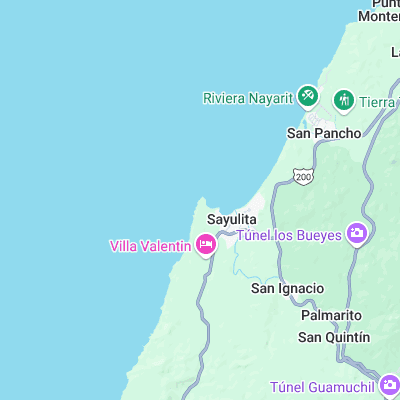
Surf spots nearby
- San Pancho (2.9 mi)
- Lalancha (8.8 mi)
- Veneros (9.1 mi)
- Puerto Vallarta (9.9 mi)
Not Magic Seaweed (MSW)
Although we look a bit like Magic Seaweed we are not MagicSeaweed as they no longer exist...