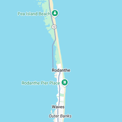
S-Turns Surf Report
| Wave height * | 4.5ft / 1.4m |
|---|---|
| Swell period | 8s |
| Swell direction | |
| Wind | |
| Sea temp | 21°C / 69°F |
10 day S-Turns surf forecast
Tue
16
12
16
- High 12:16am
- Low 5:49am
- High 12:36pm
- Low 7:32pm
Wed
9
8
8
- High 1:06am
- Low 6:39am
- High 1:26pm
- Low 8:29pm
Thu
5
4
6
- High 2:04am
- Low 7:41am
- High 2:21pm
- Low 9:25pm
Fri
6
3
6
- High 3:12am
- Low 8:55am
- High 3:21pm
- Low 10:16pm
Sat
10
16
15
- High 4:22am
- Low 10:17am
- High 4:27pm
- Low 11:05pm
Sun
13
14
16
- High 5:26am
- Low 11:35am
- High 5:34pm
- Low 11:53pm
Mon
8
12
13
- High 6:23am
- Low 12:44pm
- High 6:38pm
Tue
7
9
12
- Low 12:42am
- High 7:15am
- Low 1:45pm
- High 7:37pm
Wed
26
28
30
- Low 1:32am
- High 8:05am
- Low 2:42pm
- High 8:31pm
Tue 5th Nov
| 4:00 | 4.5ft | 5.2ft | 8s | 17mph (23mph) | |||
| 7:00 | 4.5ft | 5.3ft | 7s | 16mph (21mph) | |||
| 10:00 | 4ft | 5ft | 7s | 13mph (15mph) | |||
| 13:00 | 4ft | 4.7ft | 8s | 12mph (15mph) | |||
| 16:00 | 3.5ft | 4.5ft | 10s | 12mph (15mph) | |||
| 19:00 | 3.5ft | 4.5ft | 9s | 16mph (22mph) |
| Tide times |
|---|
| High 12:16am (0.69m) |
| Low 5:49am (0.20m) |
| High 12:36pm (0.97m) |
| Low 7:32pm (0.18m) |
| Daylight | |
|---|---|
| First light | 06:01 |
| Sunrise | 06:28 |
| Sunset | 17:02 |
| Dark | 17:29 |
Wed 6th Nov
| 4:00 | 3.5ft | 4.4ft | 9s | 11mph (14mph) | |||
| 7:00 | 3.5ft | 4.3ft | 9s | 9mph (11mph) | |||
| 10:00 | 3.5ft | 4.3ft | 8s | 9mph (12mph) | |||
| 13:00 | 3.5ft | 4.3ft | 8s | 8mph (10mph) | |||
| 16:00 | 3.5ft | 4.2ft | 8s | 7mph (7mph) | |||
| 19:00 | 3ft | 4ft | 8s | 8mph (8mph) |
| Tide times |
|---|
| High 1:06am (0.68m) |
| Low 6:39am (0.21m) |
| High 1:26pm (0.96m) |
| Low 8:29pm (0.18m) |
| Daylight | |
|---|---|
| First light | 06:02 |
| Sunrise | 06:29 |
| Sunset | 17:01 |
| Dark | 17:28 |
Thu 7th Nov
| 4:00 | 3ft | 3.5ft | 8s | 6mph (6mph) | |||
| 7:00 | 2.5ft | 3.3ft | 8s | 5mph (5mph) | |||
| 10:00 | 2.5ft | 3.2ft | 8s | 4mph (4mph) | |||
| 13:00 | 2.5ft | 3.1ft | 8s | 4mph (4mph) | |||
| 16:00 | 2ft | 2.9ft | 8s | 6mph (6mph) | |||
| 19:00 | 2ft | 2.8ft | 8s | 6mph (6mph) |
| Tide times |
|---|
| High 2:04am (0.69m) |
| Low 7:41am (0.23m) |
| High 2:21pm (0.94m) |
| Low 9:25pm (0.18m) |
| Daylight | |
|---|---|
| First light | 06:03 |
| Sunrise | 06:30 |
| Sunset | 17:00 |
| Dark | 17:27 |
Fri 8th Nov
| 4:00 | 2ft | 2.6ft | 8s | 4mph (4mph) | |||
| 7:00 | 2ft | 2.5ft | 8s | 6mph (6mph) | |||
| 10:00 | 2ft | 2.8ft | 8s | 4mph (4mph) | |||
| 13:00 | 2.5ft | 3.4ft | 7s | 3mph (3mph) | |||
| 16:00 | 3ft | 3.8ft | 6s | 3mph (3mph) | |||
| 19:00 | 2ft | 3.5ft | 5s | 6mph (6mph) |
| Tide times |
|---|
| High 3:12am (0.73m) |
| Low 8:55am (0.23m) |
| High 3:21pm (0.92m) |
| Low 10:16pm (0.16m) |
| Daylight | |
|---|---|
| First light | 06:04 |
| Sunrise | 06:31 |
| Sunset | 17:00 |
| Dark | 17:26 |
Sat 9th Nov
| 4:00 | 2.5ft | 3.4ft | 9s | 6mph (7mph) | |||
| 7:00 | 2.5ft | 3.5ft | 9s | 10mph (11mph) | |||
| 10:00 | 2.5ft | 3.5ft | 9s | 12mph (14mph) | |||
| 13:00 | 2.5ft | 3.4ft | 9s | 16mph (17mph) | |||
| 16:00 | 2.5ft | 3.4ft | 9s | 16mph (19mph) | |||
| 19:00 | 2.5ft | 3.4ft | 10s | 15mph (20mph) |
| Tide times |
|---|
| High 4:22am (0.80m) |
| Low 10:17am (0.22m) |
| High 4:27pm (0.89m) |
| Low 11:05pm (0.14m) |
| Daylight | |
|---|---|
| First light | 06:05 |
| Sunrise | 06:32 |
| Sunset | 16:59 |
| Dark | 17:25 |
Sun 10th Nov
| 4:00 | 3ft | 3.8ft | 9s | 9mph (12mph) | |||
| 7:00 | 3ft | 3.8ft | 9s | 13mph (18mph) | |||
| 10:00 | 3ft | 3.8ft | 9s | 13mph (19mph) | |||
| 13:00 | 3ft | 3.8ft | 9s | 14mph (20mph) | |||
| 16:00 | 3ft | 3.8ft | 9s | 15mph (25mph) | |||
| 19:00 | 3ft | 3.6ft | 9s | 16mph (27mph) |
| Tide times |
|---|
| High 5:26am (0.91m) |
| Low 11:35am (0.18m) |
| High 5:34pm (0.87m) |
| Low 11:53pm (0.13m) |
| Daylight | |
|---|---|
| First light | 06:06 |
| Sunrise | 06:33 |
| Sunset | 16:58 |
| Dark | 17:25 |
Mon 11th Nov
| 4:00 | 3ft | 3.5ft | 9s | 12mph (20mph) | |||
| 7:00 | 2.5ft | 3.3ft | 9s | 8mph (13mph) | |||
| 10:00 | 2.5ft | 3.1ft | 9s | 13mph (17mph) | |||
| 13:00 | 2.5ft | 2.9ft | 9s | 12mph (14mph) | |||
| 16:00 | 2ft | 2.7ft | 9s | 16mph (16mph) | |||
| 19:00 | 2ft | 2.6ft | 9s | 13mph (12mph) |
| Tide times |
|---|
| High 6:23am (1.01m) |
| Low 12:44pm (0.13m) |
| High 6:38pm (0.86m) |
| Daylight | |
|---|---|
| First light | 06:07 |
| Sunrise | 06:34 |
| Sunset | 16:57 |
| Dark | 17:24 |
Tue 12th Nov
| 4:00 | 1ft | 3.3ft | 7s | 4mph (3mph) | |||
| 7:00 | 2ft | 3.9ft | 5s | 7mph (6mph) | |||
| 10:00 | 2ft | 4.3ft | 5s | 7mph (8mph) | |||
| 13:00 | 2ft | 4.1ft | 5s | 9mph (10mph) | |||
| 16:00 | 2.5ft | 4.2ft | 6s | 8mph (12mph) | |||
| 19:00 | 2.5ft | 4.2ft | 6s | 12mph (15mph) |
| Tide times |
|---|
| Low 12:42am (0.11m) |
| High 7:15am (1.11m) |
| Low 1:45pm (0.08m) |
| High 7:37pm (0.86m) |
| Daylight | |
|---|---|
| First light | 06:08 |
| Sunrise | 06:35 |
| Sunset | 16:56 |
| Dark | 17:23 |
Wed 13th Nov
| 4:00 | 3ft | 5ft | 6s | 27mph (26mph) | |||
| 7:00 | 3.5ft | 4.9ft | 6s | 26mph (28mph) | |||
| 10:00 | 3.5ft | 5ft | 6s | 26mph (29mph) | |||
| 13:00 | 4.5ft | 5.6ft | 8s | 28mph (30mph) | |||
| 16:00 | 5.5ft | 6.6ft | 9s | 31mph (35mph) | |||
| 19:00 | 6ft | 6.9ft | 10s | 30mph (32mph) |
| Tide times |
|---|
| Low 1:32am (0.09m) |
| High 8:05am (1.17m) |
| Low 2:42pm (0.04m) |
| High 8:31pm (0.86m) |
| Daylight | |
|---|---|
| First light | 06:09 |
| Sunrise | 06:36 |
| Sunset | 16:56 |
| Dark | 17:23 |
Thu 14th Nov
| 4:00 | 6ft | 7.2ft | 10s | 24mph (24mph) | |||
| 7:00 | 7ft | 7.7ft | 10s | 20mph (20mph) | |||
| 10:00 | 7.5ft | 8.6ft | 11s | 17mph (16mph) | |||
| 13:00 | 8ft | 8.8ft | 11s | 15mph (14mph) | |||
| 16:00 | 8ft | 8.8ft | 11s | 11mph (9mph) | |||
| 19:00 | 8.5ft | 9.3ft | 11s | 7mph (7mph) |
| Tide times |
|---|
| Low 2:23am (0.08m) |
| High 8:55am (1.20m) |
| Daylight | |
|---|---|
| First light | 06:10 |
| Sunrise | 06:37 |
| Sunset | 16:55 |
| Dark | 17:22 |
Nearest buoys
When its on S Turns is on its often compared to the classic French beaches. Top to bottom, sand dredging pits breaking practically on the beach are the go. Yep, it gets that good, but it is also the most crowded spot on the Outer Banks
S-Turns gets it's name, not from the carving action you might make in attempt to gain speed as you won't be needing to! but from the shape of the road leading to it. The break favours south swells which often arrive in the middle of summer. The north swells generally have more power but are generally more unruly. Whilst the crowding can be extreme on a good summer swell everyone tends to just get on with it and localism isn't a big deal. The option is head 5 minutes in the car north or south and you will find decent enough uncrowded waves
Surf spots nearby
- Rhodanthe Pier (1.6 mi)
- K.O.A. (2.3 mi)
- Boilers (7.7 mi)
- Avon Pier (18.2 mi)
- Outer Banks Pier (20.2 mi)
- Kite Point (22 mi)
- Jennette’s Pier (22.1 mi)
Not Magic Seaweed (MSW)
Although we look a bit like Magic Seaweed we are not MagicSeaweed as they no longer exist...