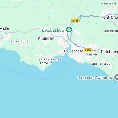
La Gamelle Surf Report
| Wave height * | 9.5ft / 2.9m |
|---|---|
| Swell period | 17s |
| Swell direction | |
| Wind | |
| Sea temp | 10°C / 50°F |
10 day La Gamelle surf forecast
Mon
24/Feb
9.5ft
18
17
11
- High 3:09am
- Low 9:32am
- High 3:38pm
- Low 9:51pm
Tue
25/Feb
6ft
18
17
15
- High 3:56am
- Low 10:17am
- High 4:20pm
- Low 10:34pm
Wed
26/Feb
4ft
19
22
7
- High 4:37am
- Low 10:58am
- High 4:59pm
- Low 11:14pm
Thu
27/Feb
2.5ft
10
10
8
- High 5:15am
- Low 11:38am
- High 5:37pm
- Low 11:53pm
Fri
28/Feb
2ft
11
10
7
- High 5:54am
- Low 12:17pm
- High 6:15pm
Sat
1/Mar
2ft
10
10
13
- Low 12:32am
- High 6:32am
- Low 12:56pm
- High 6:53pm
Sun
2/Mar
4.5ft
11
7
11
- Low 1:13am
- High 7:12am
- Low 1:37pm
- High 7:32pm
Mon
3/Mar
2.5ft
6
4
12
- Low 1:55am
- High 7:53am
- Low 2:19pm
- High 8:14pm
Tue
4/Mar
4ft
7
4
4
- Low 2:40am
- High 8:37am
- Low 3:05pm
- High 9:00pm
Wed
5/Mar
3ft
7
8
7
- Low 3:30am
- High 9:28am
- Low 3:58pm
- High 9:57pm
Mon 24th Feb
| 4:00 | 8ft | 18.6ft | 14s | 33mph (50mph) | |||
| 7:00 | 9.5ft | 19.8ft | 17s | 18mph (29mph) | |||
| 10:00 | 9ft | 19.3ft | 17s | 18mph (28mph) | |||
| 13:00 | 9.5ft | 18.2ft | 17s | 17mph (25mph) | |||
| 16:00 | 9ft | 17.1ft | 17s | 15mph (22mph) | |||
| 19:00 | 7.5ft | 16ft | 16s | 11mph (17mph) |
| Tide times |
|---|
| High 3:09am (5.74m) |
| Low 9:32am (2.11m) |
| High 3:38pm (5.86m) |
| Low 9:51pm (2.00m) |
| Daylight | |
|---|---|
| First light | 07:36 |
| Sunrise | 08:07 |
| Sunset | 18:54 |
| Dark | 19:26 |
Tue 25th Feb
| 4:00 | 6.5ft | 13.9ft | 16s | 19mph (22mph) | |||
| 7:00 | 6.5ft | 13.2ft | 15s | 18mph (24mph) | |||
| 10:00 | 6ft | 12.6ft | 15s | 18mph (22mph) | |||
| 13:00 | 6ft | 12.2ft | 14s | 17mph (21mph) | |||
| 16:00 | 5ft | 11.7ft | 14s | 16mph (21mph) | |||
| 19:00 | 4.5ft | 11.2ft | 14s | 15mph (21mph) |
| Tide times |
|---|
| High 3:56am (6.27m) |
| Low 10:17am (1.56m) |
| High 4:20pm (6.36m) |
| Low 10:34pm (1.47m) |
| Daylight | |
|---|---|
| First light | 07:34 |
| Sunrise | 08:05 |
| Sunset | 18:56 |
| Dark | 19:27 |
Wed 26th Feb
| 4:00 | 4ft | 9.8ft | 13s | 17mph (26mph) | |||
| 7:00 | 4ft | 9.5ft | 13s | 19mph (28mph) | |||
| 10:00 | 4ft | 9.8ft | 12s | 23mph (33mph) | |||
| 13:00 | 4ft | 10.9ft | 12s | 22mph (31mph) | |||
| 16:00 | 4ft | 11.2ft | 12s | 20mph (31mph) | |||
| 19:00 | 3.5ft | 9.9ft | 12s | 7mph (9mph) |
| Tide times |
|---|
| High 4:37am (6.79m) |
| Low 10:58am (1.06m) |
| High 4:59pm (6.80m) |
| Low 11:14pm (1.02m) |
| Daylight | |
|---|---|
| First light | 07:32 |
| Sunrise | 08:04 |
| Sunset | 18:57 |
| Dark | 19:29 |
Thu 27th Feb
| 4:00 | 3ft | 7.7ft | 11s | 7mph (11mph) | |||
| 7:00 | 2.5ft | 7.1ft | 11s | 10mph (14mph) | |||
| 10:00 | 2.5ft | 6.7ft | 11s | 10mph (14mph) | |||
| 13:00 | 2.5ft | 6.2ft | 11s | 10mph (11mph) | |||
| 16:00 | 2ft | 6ft | 11s | 6mph (8mph) | |||
| 19:00 | 2ft | 5.8ft | 11s | 8mph (11mph) |
| Tide times |
|---|
| High 5:15am (7.21m) |
| Low 11:38am (0.68m) |
| High 5:37pm (7.13m) |
| Low 11:53pm (0.69m) |
| Daylight | |
|---|---|
| First light | 07:31 |
| Sunrise | 08:02 |
| Sunset | 18:59 |
| Dark | 19:30 |
Fri 28th Feb
| 4:00 | 1.5ft | 5.4ft | 13s | 10mph (15mph) | |||
| 7:00 | 1.5ft | 5.3ft | 13s | 11mph (17mph) | |||
| 10:00 | 2ft | 5.1ft | 13s | 11mph (17mph) | |||
| 13:00 | 2ft | 4.9ft | 12s | 10mph (12mph) | |||
| 16:00 | 1.5ft | 4.5ft | 12s | 5mph (7mph) | |||
| 19:00 | 1.5ft | 4.2ft | 12s | 7mph (9mph) |
| Tide times |
|---|
| High 5:54am (7.49m) |
| Low 12:17pm (0.46m) |
| High 6:15pm (7.31m) |
| Daylight | |
|---|---|
| First light | 07:29 |
| Sunrise | 08:00 |
| Sunset | 19:01 |
| Dark | 19:32 |
Sat 1st Mar
| 4:00 | 1.5ft | 4.1ft | 11s | 9mph (12mph) | |||
| 7:00 | 1.5ft | 4.2ft | 11s | 10mph (13mph) | |||
| 10:00 | 1.5ft | 4.5ft | 13s | 10mph (15mph) | |||
| 13:00 | 2ft | 5.8ft | 20s | 10mph (12mph) | |||
| 16:00 | 3.5ft | 8.2ft | 19s | 10mph (12mph) | |||
| 19:00 | 4ft | 9.8ft | 18s | 13mph (20mph) |
| Tide times |
|---|
| Low 12:32am (0.54m) |
| High 6:32am (7.58m) |
| Low 12:56pm (0.44m) |
| High 6:53pm (7.32m) |
| Daylight | |
|---|---|
| First light | 07:27 |
| Sunrise | 07:58 |
| Sunset | 19:02 |
| Dark | 19:33 |
Sun 2nd Mar
| 4:00 | 4ft | 11.1ft | 17s | 9mph (12mph) | |||
| 7:00 | 4.5ft | 11.6ft | 16s | 11mph (16mph) | |||
| 10:00 | 4.5ft | 12.2ft | 16s | 9mph (14mph) | |||
| 13:00 | 4.5ft | 11.7ft | 17s | 7mph (10mph) | |||
| 16:00 | 4ft | 10.9ft | 17s | 11mph (11mph) | |||
| 19:00 | 3.5ft | 10.1ft | 16s | 11mph (16mph) |
| Tide times |
|---|
| Low 1:13am (0.58m) |
| High 7:12am (7.45m) |
| Low 1:37pm (0.62m) |
| High 7:32pm (7.14m) |
| Daylight | |
|---|---|
| First light | 07:25 |
| Sunrise | 07:56 |
| Sunset | 19:04 |
| Dark | 19:35 |
Mon 3rd Mar
| 4:00 | 3ft | 7.8ft | 14s | 4mph (4mph) | |||
| 7:00 | 2.5ft | 7.3ft | 13s | 6mph (6mph) | |||
| 10:00 | 2.5ft | 6.8ft | 13s | 5mph (5mph) | |||
| 13:00 | 2.5ft | 6.5ft | 12s | 4mph (4mph) | |||
| 16:00 | 2.5ft | 6.3ft | 12s | 9mph (8mph) | |||
| 19:00 | 2.5ft | 6.6ft | 12s | 12mph (18mph) |
| Tide times |
|---|
| Low 1:55am (0.81m) |
| High 7:53am (7.12m) |
| Low 2:19pm (1.00m) |
| High 8:14pm (6.79m) |
| Daylight | |
|---|---|
| First light | 07:23 |
| Sunrise | 07:54 |
| Sunset | 19:05 |
| Dark | 19:36 |
Tue 4th Mar
| 4:00 | 4ft | 9.3ft | 18s | 8mph (10mph) | |||
| 7:00 | 4ft | 9.5ft | 17s | 7mph (8mph) | |||
| 10:00 | 4ft | 9.1ft | 16s | 7mph (10mph) | |||
| 13:00 | 4ft | 9ft | 16s | 4mph (6mph) | |||
| 16:00 | 3.5ft | 9.3ft | 15s | 5mph (7mph) | |||
| 19:00 | 3.5ft | 9.8ft | 17s | 4mph (5mph) |
| Tide times |
|---|
| Low 2:40am (1.22m) |
| High 8:37am (6.62m) |
| Low 3:05pm (1.52m) |
| High 9:00pm (6.32m) |
| Daylight | |
|---|---|
| First light | 07:21 |
| Sunrise | 07:52 |
| Sunset | 19:07 |
| Dark | 19:38 |
Wed 5th Mar
| 4:00 | 3.5ft | 10.1ft | 18s | 6mph (6mph) | |||
| 7:00 | 3.5ft | 9.3ft | 17s | 7mph (7mph) | |||
| 10:00 | 3ft | 8.5ft | 15s | 8mph (10mph) | |||
| 13:00 | 3ft | 7.8ft | 15s | 8mph (10mph) | |||
| 16:00 | 2.5ft | 7.1ft | 14s | 7mph (9mph) | |||
| 19:00 | 2.5ft | 6.5ft | 14s | 7mph (8mph) |
| Tide times |
|---|
| Low 3:30am (1.73m) |
| High 9:28am (6.02m) |
| Low 3:58pm (2.09m) |
| High 9:57pm (5.80m) |
| Daylight | |
|---|---|
| First light | 07:19 |
| Sunrise | 07:50 |
| Sunset | 19:08 |
| Dark | 19:39 |
Long paddle out to this reef that is often the only spot surfable during big winter swells. The beach here is also surfable
Surf spots nearby
- Saint Tugen (2.3 mi)
- Gwendrez (3.3 mi)
- Pors Poulhan (4.1 mi)
- Cap Sizun (6.9 mi)
- Pors Theolen (6.9 mi)
- Baie des Trepasses (7.9 mi)
- Penhors Reef (8.1 mi)
- Penhors (8.3 mi)
- Les Roches Blanches - le Leyde (11 mi)
- Pointe Leyde (11.1 mi)
Not Magic Seaweed (MSW)
Although we look a bit like Magic Seaweed we are not MagicSeaweed as they no longer exist...